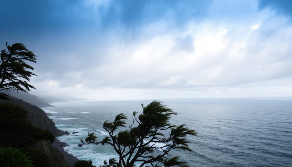
New Zealand Weather Warnings: Current Alerts & Meaning
Anyone who has checked the MetService app before heading out knows the feeling: a quick glance at the map, a scan for any splashes of colour. Weather warnings are a permanent fixture of New Zealand life, but what do those colours actually mean for your day? This guide unpacks the MetService warning system, explains how to interpret the alert levels, and gives you a clear plan for what to do when the weather turns.
Current severe weather warnings: None in force ·
Latest update: Today ·
Source: MetService official site ·
Red warnings: 0 ·
Orange warnings: 0 ·
Yellow warnings: 0
Quick snapshot
- MetService issues Severe Weather Warnings for heavy rain, strong wind, or heavy snow when conditions are expected to meet or exceed its warning criteria within the next 24 hours. (MetService Weather Warnings & Watches)
- MetService classifies Severe Weather Warnings into Orange Warnings and Red Warnings. (MetService Weather Warnings & Watches)
- Exact timing of future storms cannot be predicted days in advance.
- Localized impacts may vary within warned regions.
- Today: No active severe weather warnings. (MetService Severe Weather Outlook)
- Next 48 hours: Potential changes expected from approaching fronts; check MetService for updates. (MetService Weather Warnings & Watches)
- New Zealand is positioned in the “roaring 40s” latitude zone, where storms are common. (MetService)
MetService organises its warning system around a simple idea: make it obvious when the weather could hurt you. Five key facts, one pattern: the system uses colour and language that scale with risk, from “be aware” to “take action now.”
| Label | Value |
|---|---|
| Official source | MetService (metoffice.govt.nz) |
| Warning levels | 3: Red, Orange, Yellow |
| Update frequency | Continuous as conditions change |
| Regions covered | All New Zealand, including islands |
| Typical storm season | Year-round, peak in winter/spring |
Is a storm coming to New Zealand?
New Zealand sits between 40 and 50 degrees latitude south, a zone famously nicknamed the “roaring 40s” for the relentless westerly winds and low-pressure systems that barrel across the Southern Ocean. This geography means storms are a normal part of the climate, not an anomaly.
Right now, there are no severe weather warnings in force, according to the MetService Weather Warnings & Watches page. But that can change with as little as a day’s notice, because MetService issues warnings when conditions are expected to meet its criteria within the next 24 hours.
Current storm activity in New Zealand
At the time of writing, the MetService warning map is clear of watches and warnings. However, forecasters are watching the approach of new fronts from the Tasman Sea, and MetService Weather Warnings & Watches advises that updates can come at any time.
What meteorologists are tracking
- Frontal systems crossing the lower South Island and the Chatham Islands.
- Potential for heavy rain bands over the Tasman Sea, which can intensify quickly.
- Localised thunderstorm activity in the North Island, particularly in areas of afternoon heating.
How to check for imminent storm warnings
For real-time updates, MetService maintains a dedicated MetService Weather Warnings & Watches page that updates as conditions change.
New Zealand’s storm season is year-round, and gaps in warning coverage are rare. The system is designed to give between 12 and 24 hours of lead time for most events, but severe storms can develop faster than that.
MetService says weather forecasts and warnings may be updated at any time, so users should always check the live site for the latest information.
The implication: staying informed requires checking MetService before any outdoor plans.
Is there a severe weather warning currently in Auckland?
As of the latest update, no severe weather warnings are in force for Auckland, according to MetService Weather Warnings & Watches. MetService issues warnings for heavy rain, thunderstorms, and strong winds that could affect the region.
For Auckland specifically, the most common warnings in any season are for heavy rain and strong wind, with orange and red levels signalling more serious impacts.
Current warning status for Auckland
The live map on MetService shows no warnings active for Auckland at the time of writing.
Types of warnings relevant to Auckland
- Heavy rain warnings for the Hauraki Gulf and eastern hills.
- Strong wind warnings for the harbour bridge and western coasts.
- Thunderstorm outlooks in summer months.
What to do if a warning is in place
If a MetService warning is issued for Auckland, the MetService About Severe Weather Warnings says you should take action to protect life and property, particularly in a Red Warning context.
The pattern: clear skies today do not guarantee safety tomorrow.
Why is it raining so much in NZ?
New Zealand’s position in the Southern Hemisphere means it sits in the path of the prevailing westerlies, which drive frequent low-pressure systems eastwards across the country. These systems draw moisture-laden air from the tropics and the Tasman Sea, producing substantial rainfall, particularly on west and south-west facing coasts.
MetService’s MetService Weather Warnings & Watches page notes that heavy rain warnings are triggered when rain is expected to exceed 25mm per hour in localised areas.
Geographic and climatic factors
- The Southern Alps force moist air upwards, cooling it and causing persistent rain on the West Coast.
- The “roaring forties” wind belt means New Zealand experiences more frequent storm systems than landmasses at similar latitudes in the Northern Hemisphere.
- Sea surface temperatures around New Zealand are typically warmer than the surrounding land, which adds energy to passing depressions.
Role of frontal systems and thunderstorms
Frontal systems bring the bulk of New Zealand’s rain. When a front meets the landmass, it often triggers localised thunderstorms, especially in summer. MetService describes thunderstorm activity as most common in the North Island and the eastern South Island.
Heavy rain warning thresholds
MetService’s MetService Weather Warnings & Watches explains that heavy rain warnings are issued when rainfall is expected to exceed 25mm per hour or 50mm in six hours in a widespread area.
The interaction between mountains and deluges can cause flash flooding and slips, which are the most dangerous effects of NZ rain.
What this means: anyone in hilly areas should treat heavy rain warnings as a serious risk to property and life.
What are New Zealand’s weather warning levels?
MetService uses a three-tier colour system to communicate risk. The MetService Weather Warnings & Watches page shows these visually, but understanding what each level means can make the difference between a disrupted day and a dangerous one.
Red Warning: The most extreme
MetService’s MetService About Severe Weather Warnings states Red Warnings are reserved for the most extreme weather events, including severe weather resulting from ex-tropical cyclones.
Red means take immediate action to protect people, animals, and property. The MetService About Severe Weather Warnings page notes that Red Warnings are rare and may be linked with a State of Emergency.
Orange Warning: Take action
Orange Warnings are more common and indicate that disruption and risk to people, animals, and property are possible. MetService About Severe Weather Warnings says Orange means you should take action to prepare for the weather.
Yellow Warning: Be aware
Yellow Watches are the lowest level, meaning potential for heavy rain, wind, or snow that could disrupt a few activities. MetService About Severe Weather Warnings issues these as early heads-up, up to three days ahead.
RNZ explains that yellow corresponds to weather watches, orange to general warnings, and red to the most extreme warnings.
The catch: colour changes can happen fast, so never rely on yesterday’s map.
How to Check Live Weather Warnings for New Zealand
Checking the current warning status is straightforward. MetService’s MetService Weather Warnings & Watches page is the primary public interface.
Using the MetService website
- The MetService warnings page shows both watches and warnings on an interactive map.
- Each warning expands to show the specific regions, expected conditions, and the time window.
- MetService also provides a “Severe Weather Outlook” that covers the next five days.
Mobile apps and social media
MetService has a mobile app that sends push notifications when warnings are issued or upgraded. Following their social media accounts, including X (formerly Twitter), can also give faster updates in some cases.
National Emergency Management alerts
The National Emergency Management Agency (NEMA) can send emergency mobile alerts that interrupt your screen, but only for the most serious events. For general awareness, MetService remains the authoritative guide.
The MetService system is well-tested but conservative: Orange warnings can be raised to Red quickly when storms intensify, so don’t let a “watch” status make you complacent.
The implication: treat every preparation as an investment in safety.
Related reading: Westland Fiordland Heavy Rain: Orange Warnings and Climate Facts · Volcanoes in New Zealand: Active, Famous, Supervolcano
metservice.com, metservice.com, www2.metservice.com, metservice.com, metservice.com, x.com, 1news.co.nz, rnz.co.nz
Frequently Asked Questions
What should I do during a red weather warning?
MetService advises immediate action to protect people, animals, and property. Avoid travel, secure loose items, and follow instructions from civil defence. The MetService About Severe Weather Warnings emphasises that Red is the most extreme category and the risk to life is real.
How are weather warnings issued in New Zealand?
MetService issues them based on its MetService About Severe Weather Warnings criteria for heavy rain, wind, and snow. The process is live and updated by meteorologists.
Are weather warnings always accurate?
Warnings are based on models and observations, which can change. MetService reviews decisions continuously. You can see the confidence in its MetService Thunderstorm Outlook which explicitly states that updates may come at any time.
Can I get severe weather alerts on my phone?
Yes, the MetService app offers push notifications. NEMA also issues emergency mobile alerts for life-threatening events.
What is the difference between a watch and a warning in NZ?
MetService uses “watches” (Yellow) to indicate potential risk and “warnings” (Orange/Red) for expected conditions. A watch becomes a warning when confidence and timing improve, per RNZ Emergency Weather Warnings explainer.
Why are there sometimes no warnings even when weather is bad?
MetService may issue warnings for weather that meets its criteria, which can be different from what people see on radar. The system is tuned to be reliable, not dramatic.
How long do weather warnings typically stay in place?
Most warnings last between 6 and 24 hours, but can be extended or lifted early as conditions evolve. MetService updates its MetService Weather Warnings & Watches page continuously.
Do warnings apply to coastal areas as well?
Yes, MetService issues marine warnings for coastal and offshore waters. See the MetService Marine page for strong wind gale advisories.
Confirmed
- MetService is the official weather warning authority in New Zealand.
- Warning levels are red, orange, yellow.
- No severe warnings in force at time of writing.
What’s Unclear
- Exact timing of future storms cannot be predicted days in advance.
- Localized impacts may vary within warned regions.
For New Zealanders, the choice is straightforward: treat every Orange and Red warning as a rehearsal for the real thing. MetService reports that Red Warnings are rare—only issued for the most extreme events—so when one appears, the system is telling you to take it seriously. Stay flexible, keep a weather radar app handy, and veto any plans that depend on dry roads or calm seas. For everyone else, the storm will pass; the warnings won’t.
More related posts
 Compare House Insurance NZ: Top Sites & Trusted Providers
 Can You Carry Liquids on Domestic Flights NZ? Rules
 How to Get Rid of Fruit Flie in Kitchen: Fa t DIY Trap
 Dolce and Gabbana Light Blue: Scent, Reviews, and Buyer’s Guide
 West Auckland Internet Outage: Chorus Map & Vandalism Facts
 Pick A Part NZ: Locations, Stock List & Used Parts Guide
 Jill Rogers NZ Police – Deputy Commissioner Career and Updates
