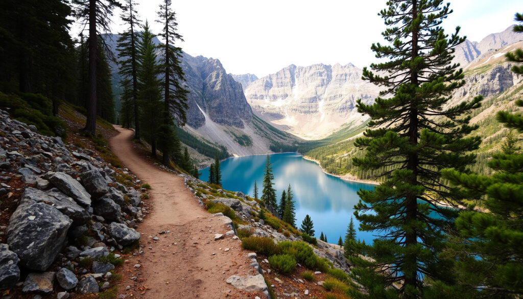
Diamond Lake & Rocky Mountain Track: Complete Hiking Guide
Hiking around Wanaka means choices — and the Diamond Lake and Rocky Mountain Track gives you two in one: stick to the easy lakeside loop or push up to the summit for a broad view over Lake Wānaka and the surrounding peaks. This guide pulls together official track specs from the Department of Conservation, local tourism data, and independent route reports so you can decide which walk fits your day.
Length: 7 km loop for Diamond Lake and Rocky Mountain Track · Walking time: About 3 hours from the car park · Difficulty: Easy to intermediate (DOC) · Summit elevation: 775 m above sea level · Start point: Diamond Lake car park on Mount Aspiring Road · Distance from Wanaka: About 18.5 km west
Quick snapshot
- DOC classifies the track as a 7 km, 3-hour easy-to-intermediate loop (Department of Conservation)
- The Diamond Lake loop alone is 2.5 km and takes about 45 minutes (Wanaka NZ)
- Summit sits at 775 m above sea level (Department of Conservation) (Department of Conservation)
- Current track conditions after rain or recent weather events are not provided in official updates
- Parking capacity at the Diamond Lake car park isn’t specified by DOC or local sources
- Difficulty classification varies between sources (DOC says easy-intermediate, AllTrails says challenging, EarthTrekkers says moderate)
- No recent track closures or events are recorded; plan under normal summer conditions
- Combine Diamond Lake loop with Rocky Mountain summit climb for a full 7 km hike
- Check MetService forecast before starting
The table below pulls official and independent route specs side by side, showing where sources agree and diverge.
| Attribute | Value | Source |
|---|---|---|
| Official length | 7 km loop | Department of Conservation |
| Time from car park | 3 hours | Department of Conservation |
| Difficulty (DOC) | Easy to intermediate | Department of Conservation |
| Summit elevation | 775 m above sea level | Department of Conservation |
| Distance from Wanaka | 18.5 km west | Department of Conservation |
| AllTrails route length | 4.8 miles loop (approx 7.7 km) | AllTrails |
| EarthTrekkers distance | 7.3 km roundtrip | Earth Trekkers |
| EarthTrekkers ascent | 520 m | Earth Trekkers |
How long is the hike around Diamond Lake?
The answer depends on how much of the trail network you tackle. The Diamond Lake loop alone is a short, easy leg-stretcher. The full Rocky Mountain Track loop adds the summit and makes for a half-day outing.
Diamond Lake loop distance and duration
- Wanaka NZ’s visitor guide lists the Diamond Lake Circuit Track as 2.5 km and 45 minutes, graded easy (Wanaka NZ).
- The same site lists the Diamond Lake Lookout return as 2 km and 1 hour, described as easy-moderate with “lots of stairs.”
Combined Rocky Mountain loop distance
- DOC states the full Rocky Mountain Track is a 7 km loop with a 3-hour return time (Department of Conservation).
- Earth Trekkers measured 7.3 km roundtrip with about 520 m of ascent (Earth Trekkers).
- AllTrails logs the same combined loop at 4.8 miles (7.7 km) and tags it as generally challenging (AllTrails).
Elevation gain and difficulty
- DOC classifies the Rocky Mountain Track as easy to intermediate but warns that sections are “steep and often slippery, even in summer” (Department of Conservation).
- The western side of the circuit involves “light scrambling on a wet, rocky and muddy trail,” while the eastern side is exposed to “steep drop-offs” requiring extreme care (Department of Conservation).
- Earth Trekkers rates the route moderate (Earth Trekkers).
The implication: pick your route based on time and comfort with exposure, not just the official distance.
Where can I park when hiking the Rocky Mountain Track in Wanaka?
Parking is straightforward, but a few details help you arrive prepared. The trailhead sits at the end of a short drive off Mount Aspiring Road.
Diamond Lake car park
- The Rocky Mountain Track starts from the Diamond Lake Conservation Area carpark on Wanaka–Mt Aspiring Road (Department of Conservation).
- The drive from Wanaka is about 18.5 km west along Wanaka–Mt Aspiring Road (Department of Conservation).
- From the car park, walkers follow a 4WD track before joining the summit loop (Tobin Ka).
Getting to Mount Aspiring Road
- Mount Aspiring Road is state highway 6 west of Wanaka; the turn-off at Hospital Flat is signed to Diamond Lake.
- The road is sealed up to the car park. No special vehicle required.
Trailhead orientation
- From the car park, the Diamond Lake loop starts immediately; the Rocky Mountain summit track branches off after the lake.
- The Department of Conservation places the track in the Diamond Lake and Hospital Flat area (Department of Conservation).
One car park serves both walks. Arrive early in summer — capacity isn’t published, but the lot can fill by mid-morning on sunny weekends.
The catch: no published parking cap means early arrival is the only reliable strategy during peak season.
What is the most popular hike in Wanaka?
Wanaka has no shortage of celebrated trails, but the Diamond Lake and Rocky Mountain Track consistently appears in top lists. Here’s how it stacks up.
Diamond Lake and Rocky Mountain Track overview
- DOC describes the track as an easy-to-intermediate walking track, making it accessible to a broad range of fitness levels (Department of Conservation).
- AllTrails lists it as a popular Wanaka-area trail for birding, camping, and hiking (AllTrails).
- The loop format makes it convenient for day visitors — no need to arrange a shuttle.
- The summit reaches 775 m above sea level, offering 360° views over Lake Wānaka and the surrounding mountains (Department of Conservation).
Other highly rated trails near Wanaka
- Roys Peak Track: 16 km return, moderate-hard, very popular but crowded.
- Isthmus Peak Track: 16 km return, moderate, fewer crowds than Roys Peak.
- Waterfall Creek Track: 6.5 km one-way, easy, alongside the lake.
How to choose a route
- If you want a short, low-effort walk: Diamond Lake loop.
- If you want a moderate summit hike without the Roys Peak queue: Rocky Mountain Track.
- If you can spend a full day: combine the two loops for a 7 km outing.
Wanaka’s most famous hike (Roys Peak) draws big crowds and requires a steep 1,500 m climb. The Diamond Lake and Rocky Mountain Track delivers a similar lake-and-mountain payoff with less elevation gain and a fraction of the foot traffic.
What this means: if summit views without the queue are your goal, this track outperforms its popularity.
What is the best month to travel to New Zealand?
The ideal month for this hike depends on your tolerance for crowds and weather. New Zealand’s seasons are flipped relative to North America and Europe, so planning matters.
Summer conditions for the track
- New Zealand’s summer months from December to February are the warmest and busiest for outdoor travel (Audley Travel).
- Daylight extends past 9 PM, giving long hiking windows.
- Trail traffic is highest in January and February.
Shoulder-season hiking in Wanaka
- Spring (September–November) and autumn (March–May) offer milder conditions and fewer people.
- Autumn colours along the lake make the Diamond Lake loop especially scenic.
- Snow can linger on the summit into early summer; check the DOC alerts.
Daylight and visitor numbers
- The best month balances warm weather, daylight, and trail traffic. Many experienced hikers prefer March or November.
- Check the Audley Travel climate guide for regional weather differences across New Zealand.
The pattern: March and November give the best compromise between stable weather and manageable crowds on this track.
What to beware of in New Zealand?
New Zealand is a safe destination, but the outdoors demands respect. A few specific hazards affect the Diamond Lake and Rocky Mountain Track more than others.
Weather and track conditions
- New Zealand weather can change quickly, especially on exposed tracks and summits (Department of Conservation).
- DOC warns the Rocky Mountain Track has “steep and often slippery” sections, even in summer (Department of Conservation).
- The eastern side of the circuit is exposed to steep drop-offs; extreme care is required (Department of Conservation).
Sun, insects, and outdoor hazards
- Sandflies are common around lakes and damp areas — insect repellent is strongly recommended.
- The New Zealand sun is intense; bring SPF 50+ sunscreen and a hat.
- Carry at least 1 litre of water per person; no reliable water sources on the summit section.
General travel safety
- Outdoor safety guidance from Smartraveller (Australian Government travel advisory) emphasises checking conditions, carrying warm layers, rain gear, food, and water.
- Let someone know your plan — cell service is patchy on the eastern side of the track.
The biggest risk on this track is complacency. An easy-to-intermediate rating can lull hikers into underpreparing. DOC’s warnings about slippery sections and drop-offs are not exaggerated.
The implication: treat the DOC difficulty rating as a minimum baseline, not a guarantee of easy going.
Five key specifications help you compare the Diamond Lake and Rocky Mountain Track at a glance.
| Specification | Detail | Source |
|---|---|---|
| Elevation gain (full loop) | ~520 m | Earth Trekkers |
| Max elevation | 775 m | Department of Conservation |
| Surface type | Mixed: gravel, dirt, rock, and mud sections | Department of Conservation |
| Steep sections | Yes, especially on the western and eastern sides | Department of Conservation |
| Scrambling required | Light scrambling on the western side when wet | Department of Conservation |
| Exposure | High on the eastern side – drop-offs | Department of Conservation |
| Wheelchair friendly | No | Plan My Walk |
| Best season | October to April | Audley Travel |
Pros and cons of the Diamond Lake and Rocky Mountain Track
Upsides
- Single car park serves both a short lake loop and a summit hike
- Easy to intermediate rating suits most fitness levels
- Summit views rival Roys Peak without the climb
- Loop format — no need to retrace steps
- Less crowded than Roys Peak and Isthmus Peak
Downsides
- Steep and slippery sections require caution
- Exposed eastern side can be dangerous in wind
- Parking can fill early in summer
- No potable water on the summit section
- Sandflies near the lake can be annoying
How to plan your Diamond Lake and Rocky Mountain Track hike
- Check conditions and pack essentials. Check the Department of Conservation track page for closures and alerts. Pack sturdy walking shoes (not trainers), at least 1 L water, rain jacket, sun protection, and insect repellent.
- Drive to the car park. From Wanaka, head west on Mount Aspiring Road (SH6) for 18.5 km to the signed Diamond Lake Conservation Area carpark. Arrive before 9 AM in summer for a spot.
- Choose your route. For a short walk: follow the Diamond Lake loop (2.5 km, 45 min). For the summit: from the car park, take the 4WD track, then follow the Rocky Mountain Track signs. The loop is 7 km and takes about 3 hours.
- Navigate the summit loop. The Department of Conservation recommends ascending the western side (some scrambling) and descending the eastern side (exposed). Take extra care on the eastern drop-offs — stay well back from the edge.
- Return and refresh. After descending, the loop brings you back to the Diamond Lake trailhead and the car park. No facilities at the car park; the nearest public toilets are at Wanaka.
The pattern: plan the loop direction around your comfort with exposure — ascending the scrambly side and descending the exposed side gives the safest line.
What we know and what remains unclear
Confirmed facts
- The track starts from the Diamond Lake car park on Mount Aspiring Road (Department of Conservation).
- The car park is about 18.5 km west of Wanaka (Department of Conservation).
- The summit is 775 m above sea level (Department of Conservation).
What’s unclear
- Current track conditions after recent weather events are not provided in the input snippets.
- Parking capacity at the Diamond Lake car park is not specified in the provided inputs.
- Difficulty classification varies between sources (DOC says easy-intermediate, AllTrails says challenging, EarthTrekkers says moderate).
- Measured distance varies: DOC says 7 km, EarthTrekkers measured 7.3 km, Tobin Ka measured 6.8 km.
- Reddit community opinions about the track are not available from the given search snippets.
The pattern: official DOC specs provide the baseline, but independent reports reveal real variation in distance and difficulty that hikers should factor into their plans.
What experts say about the Diamond Lake and Rocky Mountain Track
The Rocky Mountain Track is a 7 km loop with a 3 hour return time, and it’s classified as an easy to intermediate walking track. Sections are steep and often slippery, even in summer. The western side involves light scrambling on a wet, rocky and muddy trail. The eastern side is exposed to steep drop-offs, and extreme care is required.
— Department of Conservation (DOC track page)
Wanaka’s Diamond Lake Circuit Track is a 45 minute, 2.5 km walk graded easy. The full Rocky Mountain Summit Track return is 7 km and 3 hours, described as moderate-hard.
— Wanaka NZ (official tourism site)
This track is a 4.8-mile loop generally considered a moderately challenging route. It’s popular for birding, camping, and hiking.
— AllTrails (trail listing)
Our measured route was 7.3 km roundtrip with about 520 m of ascent. We rate it as moderate. The track starts at the Diamond Lake car park and follows a well-marked path to the summit.
— Earth Trekkers (independent route guide)
The gap between DOC’s “easy-to-intermediate” label and independent ratings of “moderate” to “challenging” means hikers should prepare for the harder end of the range.
The Diamond Lake and Rocky Mountain Track is one of Wanaka’s most efficient day hikes: one car park, two distinct walks, and a summit view that competes with the region’s best-known trails. The catch is that the easy-to-intermediate rating masks real hazards — slippery slopes, exposed edges, and changeable weather. For the hiker who wants a rewarding half-day without the Roys Peak queue, this track delivers exactly that — provided you treat the DOC warnings with the same seriousness as the summit selfie.
kiwireport.nz, lookaboutlindsey.com, theroadlesswritten.com.au, thevirtualsherpa.com, outdooractive.com, nzmcd.co.nz, meowtainpeople.com
Frequently asked questions
What is the official DOC classification of the Rocky Mountain Track?
The Department of Conservation classifies the Rocky Mountain Track as an easy-to-intermediate walking track, noting steep and slippery sections.
How high is the Rocky Mountain Summit?
The summit is 775 metres above sea level.
Where is the Diamond Lake car park located?
The car park is on Wanaka–Mt Aspiring Road, about 18.5 km west of Wanaka.
How far is the track from Wanaka?
The drive from central Wanaka to the car park is about 18.5 km, roughly 20 minutes.
What is the Diamond Lake and Rocky Mountain area known for?
The area is known for the short Diamond Lake loop, the Rocky Mountain summit views over Lake Wānaka, and its easy access from Wanaka.
What does AllTrails say about the combined route?
AllTrails lists the combined Diamond Lake and Rocky Mountain Track as a 4.8-mile loop described as generally challenging and popular for birding, camping, and hiking.
Related reading
More related posts
 Mitre 10 Garden Sheds: Costs, Types & Planning Rules
 When Does Stranger Things Season 5 Come Out? Release Dates
 Jobs in New Plymouth NZ: Salaries & Platforms
 Where to Watch Game of Thrones: Complete Streaming Guide (2025)
 Panthers vs Broncos 2025: Final Score, Date & Match Facts
 Tallest Building in the World: Burj Khalifa, Jeddah Tower & More
 Translate English to Samoan: Best Tools, Phrases & Cultural Guide
 Kia Hora te Marino Karakia: Māori Words, Translation & Meaning
